Mervent-Vouvant : Foussais Payré-La Grande Rhée
Responsabilité du randonneur
|
The list of itineraries is a simple listing of trails open to horseback riders. It is necessary to check the usability of these trails with the organisation that manages them (Town or Departmental Council). Reminder: Riding can be dangerous on the trail. You should always be in control of your horse and adapt your behaviour and your gait to the environment. |
||
Didacticiel des cartes
Maps tutorialclick on icon (waypoint) The click on icon shows a popup that gives you details and information about different accommodations and equestrian centres.
Click on the departmental route
Click once on the departmental route to access to a button. Click on the button to view the page of the corresponding path.
|
||
Personnes concernées:
Cavaliers
Distance:
27 kms
Duration:
1 jours
Percentage of paths:
98 %
Car park address at starting point:
Car park of the Town Hall of Foussais Payré
Other car parks:
Maison forestière Les Verreries (forest house)
Allée du Royoux (small car park)
Description:
Cartes IGN 1427 E - 1527 O
Easy trail
The dense forest is marked by a horseshoe. The direction of the horseshoe indicates the direction to take.
 straight
 right
right left
left
As the markings isn't numbered, It's better to have a map because som intersection could take you to other itineraies.
The trail passes through 3 fords:
- La Guilbaudière ford: it can be crossed all year round, except for flood periods.
- La Stèle Ford: it sometimes rises one meter in winter and during major floods and weather alerts.
- La grande Rhée Ford: it can be crossed all year round.
Caution : branches might be carried by the steam of Les Verreries.
Remarkable sites:

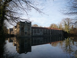
Château de La Citardière

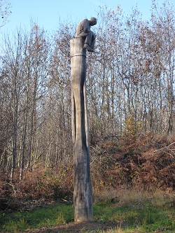
Remarkable tree
Additional information:
Dangerous areas, restrictions:
Caution at the Ruisseau des Verreries (stream)
Guilbaudière Ford and La Stèle Ford in winter
Downloads:
Printable map:


