Pays des trois rivières trail
Personnes concernées:
Meneurs
Distance:
23 kms
Duration:
1 jours
Percentage of paths:
60 %
Length of urban area:
0 kms
Car park address at starting point:
La chapelle des Lieux Saints
Other car parks:
Car park of the Etang de la Roche
Description:
A pleasant trail in a hilly area.
Inn near the Etang de la Roche with a paddock for horses.
Crêperie
Remarkable sites:

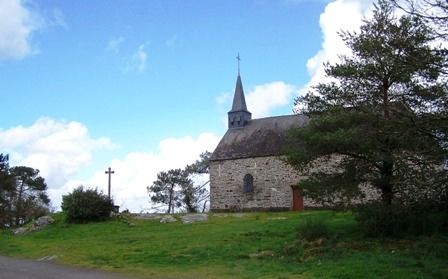
La Chapelle des Lieux Saints
It was here, at a very early date, some say the 9th century, while others say the 11th century, that Sainte Anne started to be honoured.
If we turn to the history of Château de Pontveix, we discover that a local lord, Maximilien de la Chénaie, challenged Anne of Brittany, who had been hunting nearby, to climb the Sainte Colline (Holy Hill).
http://www.mairie-guemene-penfao.fr/patrimoine.aspxhttp://www.mairie-guemene-penfao.fr/patrimoine.aspx
chateau de Juzet
Url fiche touristique:
Downloads:
Printable map:


